

Sunday morning the skies weren’t so clear. We had work to do, of course, but we were going out too. We had every intention of finding Barbrook III… honestly we did… but then again, there was the distant upright stone we had noticed the day before. The first time we had seen it in spite of the many visits we had made to this part of the moor, and in spite of driving along the road that borders it almost every time we go out to play…It isn’t as if there are trees, or even any higher ground there to have hidden it from view. Of course, it could have just appeared there, having wandered in from somewhere else… maybe it was coming to the brook to drink? There are far too many legends of this type of thing occurring in the folk history to ignore them completely. We needed to find it. See if it was still there, or had wandered off in the night. It had to be done.

No, we are not losing the plot altogether here… there are other stones, one in particular, that wander. One, bigger than any my companion had seen before, had already led us on several wild goose chases… not that we minded, as each one had taken us into adventures anyway, from the fairy woman in the ice-cream van, to the valley of dancing trees and most recently, to the ‘discovery’ of the Crone Stone. Perhaps that is the errant stone’s mission… to guide us through the wild places in search of mysteries.

We walked the familiar path beside the stone row, half hidden in the grass and growing bracken. Many who pass this way will see only a few more boulders, not realising they walk an ancient and probably sacred route marked by the stones. There is a real sense of privilege in having been able to get to know these sites better. They are free to the winds, no price is charged not barrier set between these ancient sites and the visitor, but there is a price nonetheless, paid in time, effort and the cold of winter weather, for those who would really get to know the place well.

First, however, we had to cross Deadshaw Sick, a bog around the Bar brook where the sphagnum moss holds a cushion of water, masking the potholes and making walking an uncertain exercise. We would have to cross the brook too, but that we had done once before…in winter, when the greenery was low. We had been following a trail of rowan berries and the ghosts of the past, and it had been a journey full of emotion. This time, however, the day was warm, in spite of the clouds, and everywhere birds sang and wildflowers were in bloom.

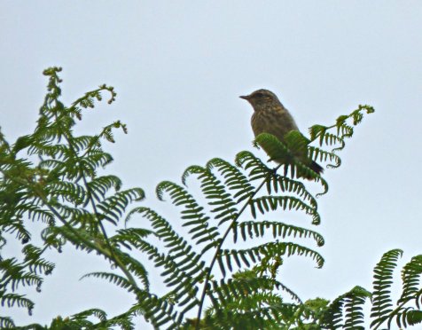
We squelched our way through the moss to where the little stream falls down to the brook from higher ground. Few come this way and there are no real paths through the stones. Small holes in the banks beside the water show a thriving community of wildlife must live here, and birds watched from the bracken, so light they barely bent the curling fronds. One, a pipit, I think, seemed to be taking an awful lot of interest in our progress.
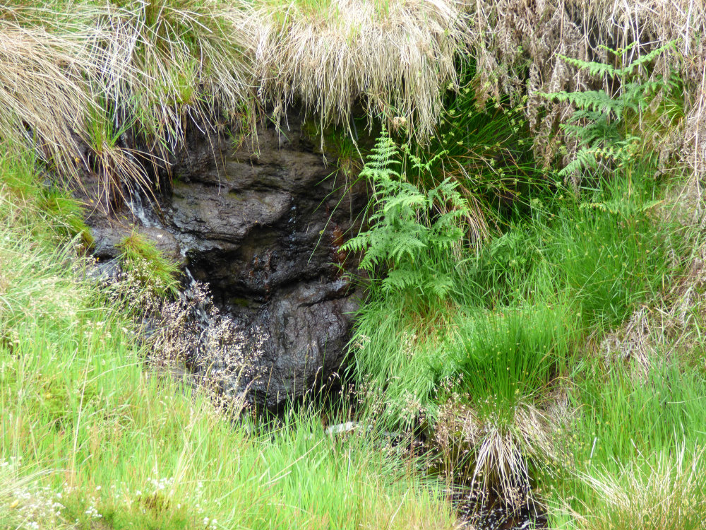
We reached the fall and greeted its guardian, the troll-like face in the water-worn rock seeming to smile a welcome at our return. You cannot walk these old, quiet places without feeling the life in the landscape and seeing it shadowed forth in the curves and colours of the stone. It is as if, walking with reverence, the land itself draws back the veils of our mundane reality, revealing the magic that waits, as it has always waited, for man to see and know.
We finally reached the guide stoop. In 1697, long before maps were commonly available to travellers and tradesmen, an Act was passed requiring the intersection of two paths to be marked in the more remote areas. Each post had the name of the next town on one face, and the accepted idea was that the traveller turned right at these intersections. There are a number of these stoops still standing in the area. Often there is a carved hand to point the way, many place names are misspelled… as here, where ‘Sheffield’ has only one ‘f’. This one is odder still, as both Bakewell and Sheffield are carved on the same face… which would doubtless result in some rather annoyed travellers, as the towns are in opposite directions from here! The stone is pockmarked with more recent traces of shells from WWII target practice; the top was blown off too. Yet still it stands, guiding, or misguiding, travelers. But this one we had seen before… what we couldn’t see was the stone we were looking for.We were beginning to wonder if it was really there….
